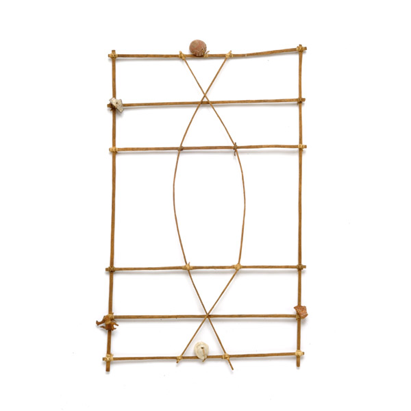
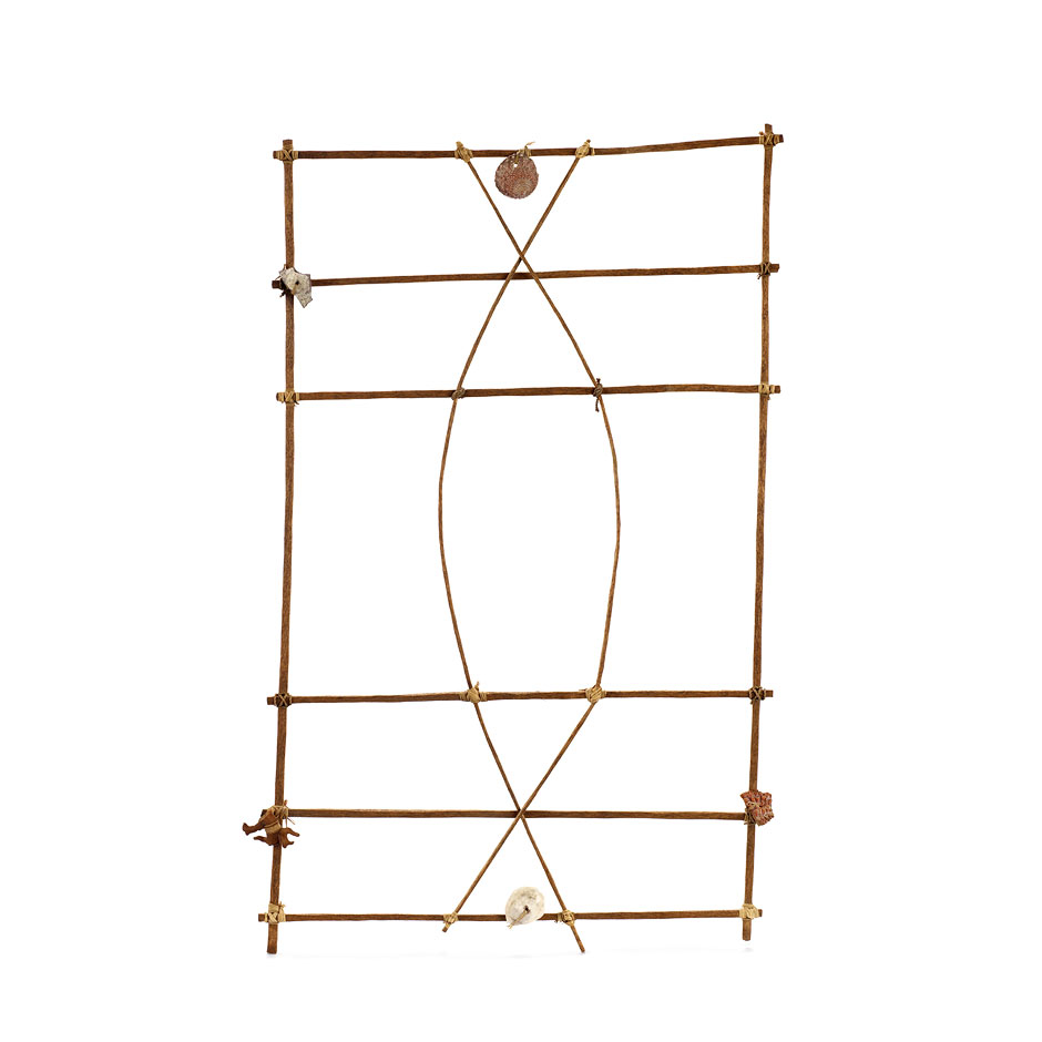
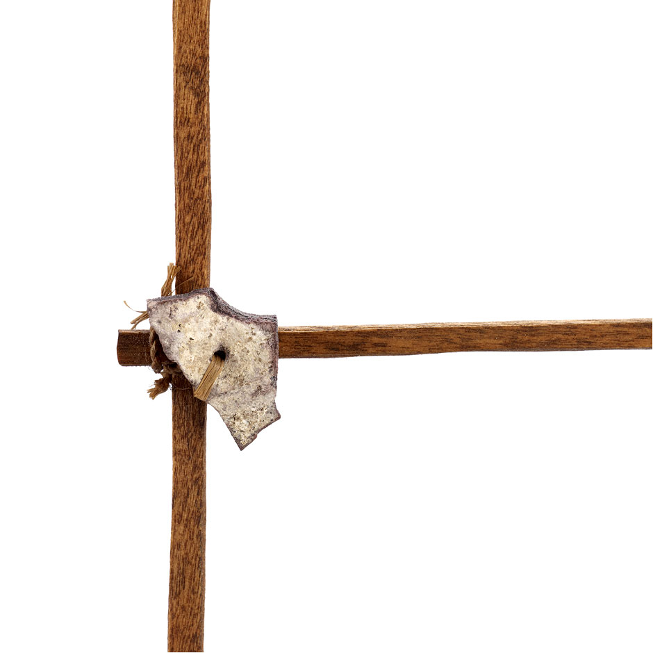
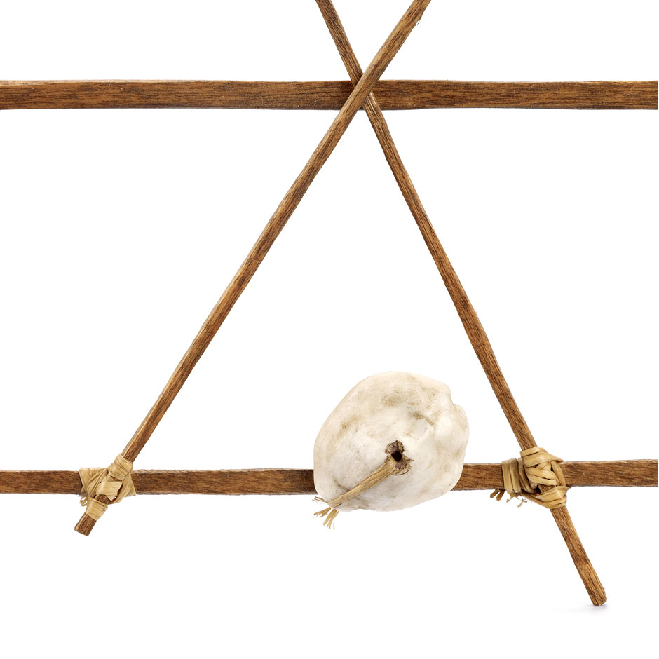
Navigation chart of the Ratak and Ralik Chains
Marshall Islands
Late 19
th - early 20
th century
Wood, coral, plant fibre, shell. H 42 cm, W 27 cm
Acquired from Adolf Rittscher circa 1930; donated by a subject of King Kabua I in 1903
MEG Inv. ETHOC 053477
Geolocate the object
Until the end of the Second World War, these charts were used to memorise the complex movements of the waves and the winds in relation to each island and atoll. Unlike European charts, they were never taken on board: they were teaching devices for young sailors and mnemonic tools for the navigators, who consulted them on land.
The image above is subject to copyright.
Copyrights for Photographic Reproduction
The art of navigation
The Pacific islands were explored and settled without navigation instruments, but with the help of sophisticated nautical technology based on the observation of natural phenomena: reading the sea, the sky, the winds and the land, interpreting their manifestations and memorising their variations. For the Pacific Islanders, the ocean was not empty, but full of signs to help them get their bearings and locate invisible lands. The ocean was not an obstacle, but a path linking the islands to one another.
In recent decades, there has been a strong upsurge of interest in the art of navigation, now seen as a way of reasserting identity and shared ancestral heritage.
Bibliograpy
- FUERST, René. 1988. Navigateurs des mers du Sud. Catalogue d'exposition. Genève: Musée d'ethnographie., 82-83
- Colombo Dougoud, Roberta. 2007. Mystérieuses cartes de navigation des îles Marshall. Totem 46: 24-25