
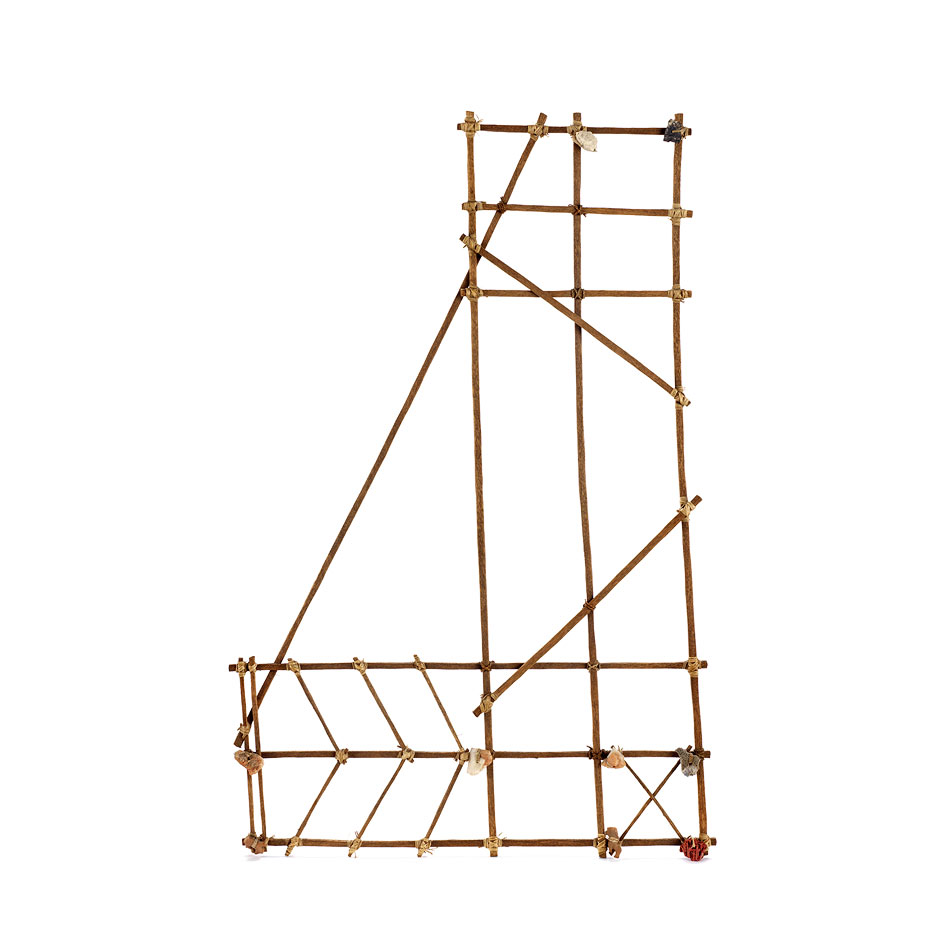
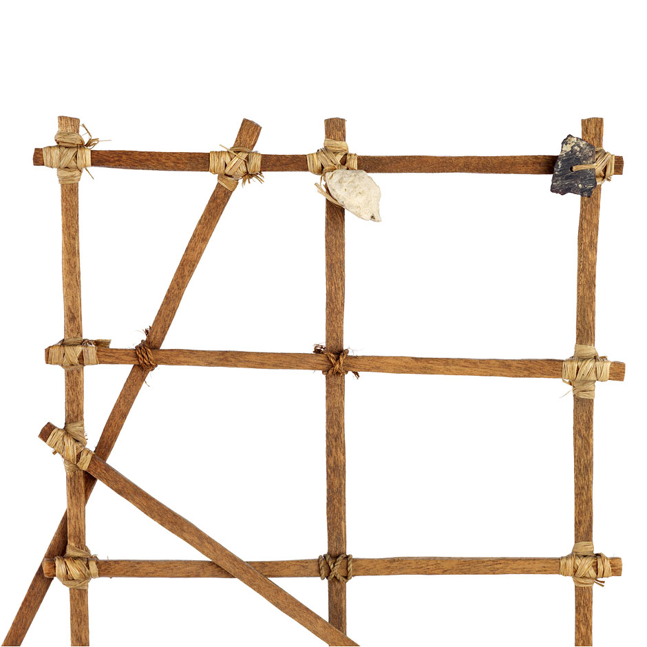
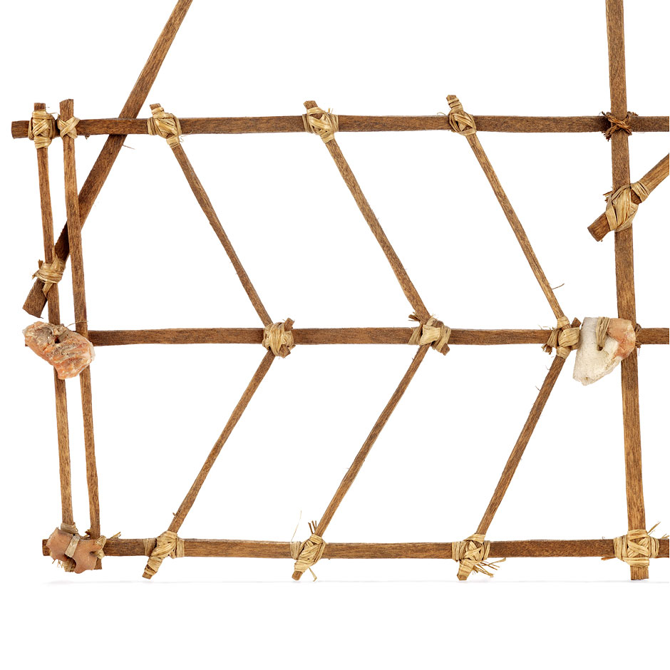
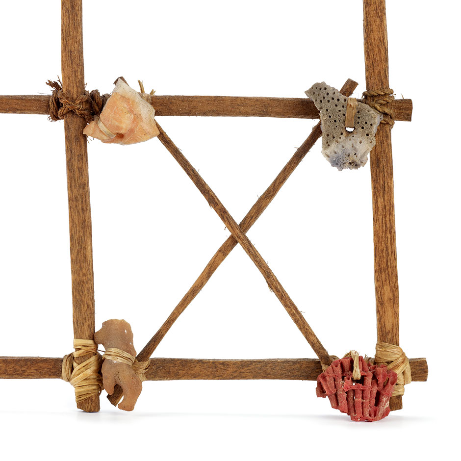
Navigation chart of the Ratak and Ralik Chains
Marshall Islands
Late 19th - early 20th century
Wood, coral, plant fibre, shell. H 45 cm, W 28,5 cm
Acquired from Adolf Rittscher circa 1930; donated by a subject of King Kabua I in 1903
MEG Inv. ETHOC 054713

Notice
Until the end of the Second World War, these charts were used to memorise the complex movements of the waves and the winds in relation to each island and atoll. Unlike European charts, they were never taken on board: they were teaching devices for young sailors and mnemonic tools for the navigators, who consulted them on land.
Bibliography
- FUERST, René. 1988. Navigateurs des mers du Sud. Catalogue d'exposition. Genève: Musée d'ethnographie., P. 84-85
- Colombo Dougoud, Roberta. 2007. Mystérieuses cartes de navigation des îles Marshall. Totem 46: 24-25

© 2015 Musée d'ethnographie, Genève
Ville de Genève, Département de la culture et du sport