


The image above is subject to copyright.
Copyrights for Photographic Reproduction
Les feuillets numérisés des registres d'inventaires historiques sont soumise à un copyright.
Droits de reproduction photographique
 Copie dactylographiée en 13 volumes de l'Inventaire original MEG manuscrit
Registres_inventaire_dactylographie/3256.pdf
Registre d'inventaire original - non indexé
Registres_inventaire_original/Registre_16_032998_034277.pdf
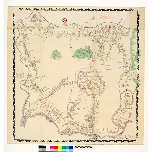
In the west of present-day Cameroon, a highland region known as the Grasslands or Grassfields shelters numerous tiny states: the Bamenda cultural area in the north, the "Bamileke" kingdoms in the south and the Bamum kingdom in the east. Before the colonial era, these kingdoms vied with one another in prestige and riches as well as in art and architecture. The kings commissioned the best sculptors and bronze casters from the neighbouring regions.
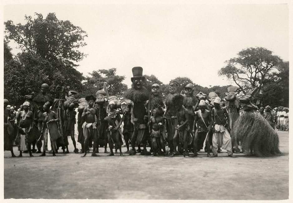
Masks performance. Bamum Kingdom. Photo by Anna Wuhrmann, Foumban, around 1920. Gifted by Josette Debarge in 1932. © Archives MEG
Descended from a princely family, Ibrahim Njoya (circa 1887-1966) was a relative of King Njoya and one of his closest collaborators. He had the same name as the king. He was involved in most of the royal inventions, including writing, and was a driving force in the development of drawing and wood carving, arts soon renowned throughout the Grassfields kingdoms. He thus incarnates the model of the modern Bamum artist, combining ancient know-how and renewal. His work explores several thematic registers and techniques: free drawing, portraits of the Bamum kings for which he laid down the conventions, maps, decorative motifs, carved panels, furniture. His drawings in the 1920s during the conflicts between King Njoya and the French colonial administration are essentially political. After the king's death in exile, Ibrahim Njoya worked for a varied foreign clientele of missionaries and travellers. The aesthetic value of his drawings then prevailed over their great historical value.
Alexandra Loumpet Galitzine

King Njimoluh, son of King Njoya, in front of regalia conserved in the Museum of the Palace of the Bamum kings at Foumban. Unknown photographer, around 1933. MEG Archives
© 2021 Musée d'ethnographie, Genève
